Thoughts Become Things

Monday, July 14, 2014

A change in plans, July 14, 2014

Thanksgiving Point Gardens
Today we intended to go into Salt Lake City and check out some of the museums and interesting spots. We started out by driving down to Thanksgiving Point Gardens, a lovely spot with an interesting history. Two professors from BYU developed a piece of software called WordPerfect. The company's success gave them  the desire to give back to the community. In 1995, they purchased land in Lehi, Utah just south of Salt Lake City, which would become a nature and cultural center.
The gardens were opened to the public in 1997. They cover 55 acres and include the 15 themed  gardens. There are four and a half miles of walking trails there. The gardens were lovely, interspersed among expansive lawns. Of particular interest here is an enormous man-made waterfall area. I say area, because there are many in the largest man-made waterfalls in the Western Hemisphere.

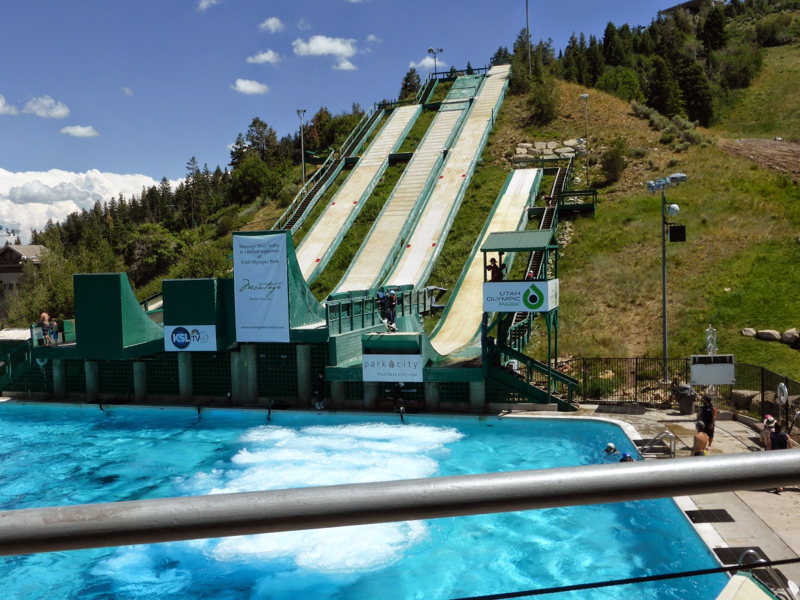
We spent a couple of hours strolling the grounds, and by the time we had finished, I was melting. The temperature was in the 90s, and rather than following through with our plans to go in town, we decided to take a drive into the mountains on the southeast side of this city and escape the heat.
What a great surprise! 

The road we took is called the Alpine Loop Scenic Highway, and runs from I-15 near Lehi to US189 in Provo Canyon. It snakes through the mountains and large stands of aspen. The white trunks of the aspen reminded me of white birch back home.  The views from the road included those of rugged peaks and treed verdant valleys. It was so peaceful and quiet, and the temperature up in the mountains was at least 10 degrees cooler than in the valley.
Aspen forest

From there, we decided to take back roads out to the Great Salt Lake on the north side of the city. The drive took us through large areas of residential development. 

We headed to Saltair, a former cabaret on the lake's shore. A better description of its location is formerly on the lake shore. When we were here in 2000, Ray took a dip in the lake whose edge was maybe 40 feet from the Saltair building . Today the lake had receded to at least one quarter mile from
The Great Salt Lake is out there somewhere. Ray took a dip here 14 years ago--when there was water here.
the building. But apparently, the lake is very shallow and it's normal for the water level to change by 2 to 3 feet annually. In some areas, a 1 foot change in elevation can cause the shoreline to move as much as 1 mile.

Tomorrow we head home. It's sad to leave the mountains, but it will be good just to
sleep in our own bed.

Lakes 7/14/2014

At Twin Lakes overlook
We've got to say it: we love Salt Lake City. It's a city sandwiched in between two sets of mountains. Turn east--beautiful mountains. Turn west--beautiful mountains. And in between, all the conveniences of a big city.

Today, we went back to the mountains for some hiking to a few lakes. Some of the trail was steep, but the views were great, with wildflowers covering the hillsides. Fortunately, we chose a longer trail that allowed us to escape the crowds of the lower and shorter trail. Apparently, people from the area use the lower lake area as a picnic spot. Along the trail, we came across assorted crazy people, such as
  • a couple who were mountain biking (Really? On a steep rocky trail that's difficult to walk on? As it was, they had to carry bikes up the steep last 1/4 mile to the second lake of our trip.)
  • some teenage boys, one of which was walking barefoot (Really? The path was strewn with rocks, and parts were layered with riprap)
At one point we saw a large bull moose grazing at the edge of the lake. It was cool to see him in his element. It is exciting to be out there in the mountains, engaging all your senses. We are so lucky to be able to experience this, and to experience this together.

Sunday, July 13, 2014

Flowers, skiing, ritzy digs and the blues, July 12, 2014


With no real plans for the day, we set out late this morning for the Red Butte Gardens, Salt Lake City's botanical garden. While this garden was not on the order of Longwood (very few gardens are), it really captured the spirit of the area. We took a short tram ride around the garden, that gave us a good idea of the various sections. We then spent an hour and a half roaming the rose, fragrance, herb, water, and medicinal gardens. 

After that, we just followed the road along, which took us to Park City, about 40 minutes away. The
Ski training
2002 winter Olympics were held here, and training still takes place here. We stopped at the freestyle skiing complex where kids were competing. We watched as the kids skied down slopes and did somersaults into a pool. The training center is also home to a museum for those Olympics. Since neither Ray nor I is very interested in skiing, we just did a walk through.

We had seen printed ads for the Deer Valley area that piqued our interest, so we headed there next. This is a resort area set in the mountains near Park City. From what we could see, it looked like an EXPENSIVE resort area. Sitting high up on a hill was the St. Regis Hotel. Access to the hotel was up an incline tram that they called a funicula. Curious as to what the inside of the hotel looked like, we boarded the funicula and rode to the top of the hill and into the hotel. Very posh. Apparently some of the rooms come with a personal butler. That's just a little outside our travel style. The views from the hotel veranda were fantastic though.
View from the St. Regis veranda

By then, we were getting hungry, so we stopped for dinner. When we emerged from the restaurant, we decided to try to find the venue for a Blues festival that was taking place in Salt Lake City. Thanks to GPS, we did find it, and were surprised that there weren't more people there. Blues groups had been playing there all day. The amphitheater was situated perfectly with the sun behind us, and the gorgeous mountains rising behind the stage. Not only was the stage lit up, but so were the mountains. As the evening progressed, and the sun lowered, the mountains took on a lovely pink glow. The first group was great, with a very talented lead female singer. The second group-- meh. The third group just wanted to jam. They were good, but not terribly interesting.

All in all, it was a good rest day for our knees.

Saturday, July 12, 2014

Cecret Lake, July 11, 2014

At Cecret Lake
Our destination today was located in the mountains to the southeast of Salt Lake City, in the Alta ski area. This is a rugged area that is only 45 minutes from the city. The drive there took us through what must be a very pricey neighborhood of large homes perched up on the mountainside.

The hike to Cecret Lake is noted for its wildflowers, and it did not disappoint. Blue, purple, red, orange, pink and yellow flowers were massed pretty much everywhere. The trail itself was not difficult, and is very popular. Unfortunately, that popularity translated into groups of people on the trail. And many of those groups were very loud. On the ascent, one boy ran ahead of his family, and stood on a rock edge ahead of us, impatiently yelling to his mother, down on the trail below, trying to get her attention. Have you ever seen Family Guy when Stewie pesters Lois for her attention? "Mom, mum, MOM, MOM!" This was like that, only more obnoxious. When we reached the lake at the top of the trail, we were dismayed to hear kids yelling and see them running around as if they were at a playground. We continued on a path around the lake to a more quiet spot where we ate lunch.

As we descended the trail, we heard thunder, but it seemed that the storm was headed away from us, so we started down another trail. We hadn't gone far, when 3 girls came up the trail from the opposite direction. They told us that they had encountered 2 large moose on the trail a short distance away. They didn't want to continue on the path, coming close to the moose, and risk having the moose take exception to their approach. We thought that perhaps the moose had moved on, so we continued along the path. We did encounter the same moose, and unfortunately they were very close to the path. Even though we waited a while, they seemed to have no intention of moving from that spot. So we did the sane thing, and turned around and retraced our steps.

We followed the entrance road back to our parking spot, and enjoyed the quiet, the mountain views, and the fabulous display of wildflowers--beautiful.

Our third trail attempt was one described as a meadow walk. We started up the trail, and shortly realized that the walk was just on a road ūnder the ski lift. Nothing great, not a lot of flowers.

OK, we tried again. This again was a meadow walk with fewer flowers than the previous one.

Time for a beer!


Friday, July 11, 2014

O give me a home... July 10, 2014

Fossil Butte--The top of the Butte was once at the bottom of Fossil Lake
Today we left Lander, WY and headed toward Salt Lake City via Fossil Butte National Monument. The ride took us through some wide open country where snow fences ran for miles and miles. We passed signs that advised "Antelope entering highway at 55 mph", and thought that the Wyoming
highway department must have a sense of humor. But a Google search showed that, sure enough, antelope can run that fast, and since the road is wide open, an antelope collision was a distinct possibility.

One deserted road led to another, and then through metropolitan Kemmerer (population 2636), out to Fossil Butte. Fossil Butte is a semi-arid landscape of flat-topped buttes and ridges, covered with sagebrush and other desert shrubs and grasses. It's hard to imagine that this was once a sub-tropical climate with a lake teeming with life. The rocks in the butte have provided the evidence that this is the case.

52 million years ago, where the top of the butte is now, was then the bottom of Fossil Lake, then 60 miles long and 40 miles wide. The lake was nestled among mountains in a lush forest. Willows, beeches, oaks, palms, maples and ferns grew around the lake. We learned much from park ranger  John Collins about this place. While the area has drastically changed from that epoch, the rocks in the butte have yielded a remarkable picture of the lush life that existed here then. In the park museum, we saw fossils of fish species that currently live in sub-tropical areas of the world today. These are fossils from 50 million years ago!We spent 2+ hours here, and then pushed on to Salt Lake City.

We stopped to get a few groceries, and then checked into our accommodations for the next 5 nights.
On our return from dinner, we noticed thick smoke billowing from an area not too far away. It turned out that there was a large fire in a 50 foot mulch pile, and high winds were not only making fighting the fire difficult, but also carrying the smoke across the city.

Thursday, July 10, 2014

Sinks Canyon, July 9, 2014

The Sinks
About 2 hours south of Thermopolis is Lander, WY, home to Sinks Canyon State Park. This is a rugged canyon at the base of the southern Wind River Mountains. Located on the eastern slope of the mountains, the canyon is named for a unique geologic formation where the river vanishes underground near the mouth of the canyon (the Sinks) and reappears above ground a short distance away. 

Here we hiked a poorly marked loop trail that took us through fields of what were now faded flowers that looked like they might have been black-eyed susans. We must have missed the grand display by a week or two. Because the trail was very poorly marked, what should have been a 4 mile trail turned into at least 5. We overshot our turn in the trail, and had to backtrack. Then when we found the trail again, we lost it one more time, and had to backtrack again. 

We stopped for lunch, and then Ray decided that he really wanted to hiked the trail in the park that led to a waterfall. I was concerned that that trail was almost completely (as we had been warned) in the sun, with little shade. By that point, I was already cooked by the sun. Ray pressed his point, and I relented. We hiked up at least 1.25 miles, when I was running out of water, and my knee was yelling at me, and I decided to call it quits. We returned to the car, and stopped at the Rise-- the place where the river reemerges from the ground. Hundreds of large trout were basking in a large pool there. The trout went upstream to that point, and could not go any further. That area is protected from fishing, so the fish are safe, so they stay in that area. Pretty cool.

By then, we were ready to chill out (literally) in some AC with a beer, so we checked into our motel. It's an older motel, and before I had booked it, I read reviews that said not to judge a book by its cover. So right! The outside looks like a 60s throwback. But the inside of our room was large, ultra-clean, and modern with a fridge and microwave, and a nice view out the windows.

Thermopolis, WY, July 8, 2014


Under the mineral dome is a stone tepee built in 1909 to vent steam from the mineral water that was piped throughout the park. As water flowed over the structure, it deposited minerals that hardened as the water cooled, creating travertine similar to the terraces around the springs of the park.
Thermopolis, WY is the largest town in Hot Springs County, with a population of 3009. That will give you an idea of the area in which it's located. Thermopolis has the world's largest mineral hot springs at Hot Springs State Park. The springs are open to the public for free as part on an 1896 treaty signed with the Shoshone and Arapahoe Indian tribes.

Our first foray of the day was to this state park. We took the boardwalk trail by the springs across a swing bridge by the Big Horn River. It was a gorgeous day, with bright blue skies, and light breezes.

After touring the springs (roughly reminiscent of Mammoth Hot Springs at Yellowstone), we decided to take a drive to Wind River Canyon south of town. The river is called the Wind River on the Shoshone reservation, and at the boundary of the reservation, it becomes the Big  Horn river, at a
Wind River Canyon
place called the Wedding of the Waters. It is surprising, and Ray had noticed that, as you travel south, you have the impression that you are traveling down hill, but the river is flowing against you, which makes it appear to flow uphill. This is a beautiful area.

After lunch, we drove to Legend Rock, an important petroglyph site that features hundreds of individual petroglyphs spread across the rock. Many of these petroglyphs are 6000-11000 years old. This area seems very remote, but it is actually only about 20 miles from Thermopolis. The remarkable thing is that these petroglyphs were not far from the path from which they can be viewed. We really enjoyed this visit.

On the way back to town, we had seen signs for a town called Hamilton Dome. We wondered what it looked like, and what the people who lived there could possibly do in such a remote area. So we took the side road an followed it to what is now an abandoned town,  hosting an oil field.

By then, it was time for dinner. We went to a restaurant in Thermopolis that had been recommended to us. The food (when it finally came) was fine, but our waitress forgot to put our order in, and we waited forever for our order to arrive. When it finally came, they brought me the wrong meal. Ray was half done his meal by the time the right meal arrived. The owner comped our meals, including ginormous pieces of german chocolate and carrot cake.

Final note:WiFi at our motel is abysmal.

Wednesday, July 9, 2014

Glacier! July 2, 2014

Our Lady of the Rockies
After a great sleep, and breakfast, we headed north from Pocatello towards St. Mary, MT, about an 8 1/2 hour ride. Our trip took us through the farms of southern Idaho, nestled in the valley between the mountains. We did not stop at the Potato Museum in Twin Falls, but we did stop at the rest area in Lima, MT so I would have cell service for my weekly conference call. What beautiful, wide-open country! As we passed through Butte, MT, I noted a large white object up on the mountain top ahead. I couldn't steady the binoculars to get a look, but we agreed that it looked to be a statue. A search online told us that it was Our Lady of the Rockies, a 90-foot statue that was dedicated in 1985. Read the story here. Moving north from Butte, we saw evidence, for the first time on this trip, of pine beetle damage. At least half the trees on the mountains on both sides of the road were dead. We left  I15 and started up Montana 287, a stunning 2 lane road that traverses green rolling hills. For most of our time on that road, we saw VERY little traffic, VERY few structures (houses, barns, or anything else). At one point, we came within seconds of hitting a coyote who dashed across the road just ahead of us. We also stopped to learn the story of the towns of Augusta and Gilman, MT.
Montana 287

We arrived at our KOA cabin at about 6:00, threw our stuff in the cabin, and sat down on the porch swing to relax with a beer. By the time we were ready for dinner, it was getting late. Many of the restaurants in the area were either closed or in the process of closing, so we opted to try the barbecue being offered at the campground. Not bad!
One thing that's hard to not notice is how long the days are here. The sun is up til almost 10:00. Time does get away from you here, and that's not a bad thing. One other note: we were dismayed by the fact that the views of the mountains were obscured to some degree by a milky haze. When we inquired, we were told that the haze was from a fire up in Canada. Hopefully, the winds will blow the smoke away by tomorrow.

Tuesday, July 8, 2014

Waterton, July 6, 2014

Last night was unusual for a KOA stay. Not only were there some people setting off fireworks off the campground property during the wee hours of the morning, but the people in the cabin opposite ours decided to have a loud party til 2:00 a.m. The only reason it ended then, was that I got up, got dressed, and marched over there, with a reminder for them that there were people in the surrounding cabins that were trying to sleep, and with a request to SHUT UP! Surprisingly, they complied.
This morning, we showered, had coffee and breakfast, then set off for Waterton, the Canadian park just north of Glacier. The border crossing was uneventful, and a red fox watched at the side of the road as we passed by just at the Waterton entrance.

Our first hike there was called Bear Hump, a promontory that overlooks the town of Waterton and the lakes. This hike was like climbing the Empire State Building with lots of rocks in the way. The trail
View from the top of Bear Hump
itself is steep: the rise of 738 feet came over a relatively short trail--.9 miles one way. The way it
managed the inclined was by steps, each with a rise of anything from 5 inches to 18 inches. This made both the trail's ascent and descent quite challenging for both of us, just having had knee surgery.  But the view at the top was worth it--360 degree views of mountains, lakes and prairies.
Another view from the top-- The Prince of Wales Hotel is in lower left of photo
Absolutely spectacular.
The trip back down from Bear Hump--steep!

After this hike, we drove to a meadow area that was exploding with purple lupine and bright yellow daisies, and there we ate lunch.

We had been recommended to take the drive out to the Red Rock Canyon area, and try a few hikes there. We took the short trail around hte Red Rock Canyon of the Bauerman Creek. Very scenic. From there, we hiked up to Blakiston Falls, through piney woods on a flower-lined path. The falls had several viewpoints, all of which were very cool.

After a short tour around the town of Waterton, we headed back east out of the park. One note about Canada, that we had experienced in other travels as well, the signage is really terrible. The sign for the turn south from route 5 heading for the US border was about 12 inches square. Needless to say, we overshot our turn by about 8 miles. No worries, it was a beautiful ride.

Back at the cabin, it was time for chardonnay, then dinner at Johnson's restaurant, homemade everything: soup, fried chicken, mashed potatoes and gravy, coleslaw (fantastic) and biscuits. I'm not sure whether I like Johnson's or 2 Sisters better. I think Johnson's wins by a hair.

Tomorrow we leave this special place (Glacier), and head for Thermopolis, WY. I hope they have better WiFi there.

Iceberg trail July 5, 2014

View at the top of the trail
Today we took a drive up to the Many Glacier area of Glacier, about a 40 minute drive north of the St. Mary area where we are staying. Our goal today was to hike the Iceberg Lake trail, probably the most beautiful trail we have ever hiked, and our prohibitive favorite. Unfortunately, because a bridge had washed out 2.6 miles in, that was as far as we could hike. 

Iceberg Lake trail
But that 2.6 miles in and the return were absolutely fantastic. The first 1/4 mile (at most) is steep, as the trail ascends to a ridge on which most of the walk is done. You come up that steep path to an open meadow that showcases the grandeur of the mountain peaks that surround you. From there, the path is mostly level, and is bounded by hillsides that are carpeted with wildflowers: red, orange and coral colored indian paintbrush, bluebells, yellow potentilla, daisies, white beargrass and countless other flowers. In some places, the flowers would appear in a group, a bank of red paintbrush, for example. In other places, it was a riot of colors all mixed together. Here, the mountains feel near to you--a part of you.

We stopped for a while at the trail terminus, the broken bridge at Ptarmigan Falls. Snow and water had ripped one side of the bridge off its footings, and the swiftly rushing water from the falls prevented sane people from wading across to the other side. While we ate our lunch there and
Bridge out  at trail's end
watched, 2 not-so-sane people did brave the treacherous water to get to the other side to complete the trail. A ranger had told us that the last part of the trail was snowbound, and that the lake was still completely iced over.

As we neared the end of our walk, I found myself walking more slowly, and taking more pictures. I became aware of the feeling that I really didn't want to leave this place. But on we went.
 
After this hike, we explored the Many Glacier Hotel and its amazing views. It sits on the shore of Swiftcurrent Lake, facing some
beautiful snow-capped peaks. We then drove down the road, pulled into a viewpoint area, and enjoyed a couple of beers as we took in the vista.
Back at our cabin, we had a glass of wine, then headed to the 2 Sisters restaurant for dinner. It's a great little restaurant with great pie (blackberry-peach a la mode!)

Two Medicine and more, July 4

The view out our cabin window
I woke very early this morning to the sound of howling wind. Since Ray was on the side of the bed adjacent to the window opener, and the window was open, I nudged him awake to get him to shut the window. That cued us in for the weather for the rest of the day--windy. We got up late, ate breakfast, and then set out for the Two Medicine area on the southeastern side of Glacier. We were fortunate to
from the boat towards Mount Sinopah
be able to get tickets for the boat ride on Two Medicine Lake that would take us across the lake to a
trail that leads to Twin Falls. A park ranger led the hike that took us along a forested path, heavy with wildflowers, and interspersed with mountain views. On the trail, we came upon a large pile of fresh bear scat. Apparently, this is a favorite bear habitat. We enjoyed the leisurely walk back to the boat launch for the
Twin Falls
trip back.


From Two Medicine, we went south to East Glacier, the site of the first lodge in the area, constructed in 1913. The lobby area is 100 feet x 200 feet, and is lined with Douglas fir columns that are 40 feet tall and between 36 and 42 inches in diameter. Each column was brought in from the Pacific northwest, because trees in Montana rarely grow so large. A total of 60 trees were used. Very cool.

By then, we decided to head west toward West Glacier, with the intent to drive from west to east on the Going to the Sun road. We stopped at Lake McDonald for dinner.

Bird Woman Falls on the GTTS Road
My god, how incredibly beautiful Glacier is. It was great going on the road at this time of day, seeing the light fade from the day, with the sun illuminating the mountains. An added bonus was the lack of other traffic. We almost had the road to ourselves. At one place we stopped and were struck by the incredible beauty of the way the sun reflected off the river in the valley. The river looked like a silver ribbon thrown on the valley floor. I got goosebumps and couldn't tear my eyes away from it. At each turn of the road (and there are many), the sheer cliffs and green forested slopes appeared in a different light- sometimes in shade, sometimes in the warm light of the fading day. As we finished our drive, after having exited the park at the east terminus, we saw a number of cars clumped by the side of the road. Sure enough--bear sighting. A golden colored black bear (they come in all colors, we learned), was foraging in a field. We continued on to our cabin, where our day ended with a fireworks display that we enjoyed while sitting on the swing on our porch. What a country!

The falls (pun intended) July 3, 2014

At St. Mary Falls


Skies were cloudy when we got up this morning, but it did appear that the smoky haze of yesterday had cleared. After breakfast, with skies clearing, and temperatures warming to the 70s, we headed out to check out the Going to the Sun road, the road that transverses the park. It had been closed for winter, and had been partly opened after snow clearing on both the east and west sides as of yesterday when we had checked the park website.  When we checked in yesterday, we were told that the road had opened all the way through the previous evening. Great timing on our part...

Because of construction, the road in many (most) places was gravel, and very dusty. The trailhead for one of the trails we wanted to follow was closed due to this construction, so we opted to do the St. Mary and Virginia Falls trail. Because of heavy snowfall this past winter, all the falls were roaring. On this trail there are actually 4 sets of falls, 2 of which are unnamed. And the views from the trail were, as we expected, fabulous. When we approached the end of the trail at Virginia Falls, there was
a spur to take you to a scenic view of the falls. We took the spur, and were rewarded with a great view, and a shower of mist from the falls. At this point, Ray found the path to continue on up to the falls. It was overgrown with brush, and very steep and slippery, due to the shower from the falls. At one point, we had to cross a stream. Ray managed to cross OK, but mid-crossing, I slipped on a wet log, and was upended, landing with a muddy splat. With muddy and wet shoes, shirt, pants and socks, I righted myself, and we continued on to the falls. Lo and behold at the falls, we found the actual trail that we should have taken. We should have backtracked when we were done at the view area, rather than continuing on from there. Now we know.

After the hike, we took a few short jaunts down trails off the GTS road.
Sunrift Gorge
Then we headed back to the cabin for a glass of wine and then dinner at the Park Cafe, just down the road from the campground. After dinner, we took a stroll around the campground. Tomorrow we'll head to a different section of the park.

Driving day, July 7

Windmills in MT
We left the warm embrace of the mountains for the rolling plains that are eastern Montana and northwest Wyoming. Farms, ranches and open space to the horizon were the order of the day. Most of the trip was on 2 lane roads with posted speeds of 70-75 mph., and much of the time we saw no one ahead of us, and no one behind. Homes along the road could only be identified by clumps of trees in the distance. Presumably the trees make good wind and snow breaks, much needed here.

Views of hay rolls to the horizon, wind farms, and the entertainment of finding out the population of places like Two Dot, MT (76), Meeteetse, WY (167), and Moccasin, MT (327), filled our day. That, and the tedium of chugging through multiple (at least 4) construction sites. It's so annoying to slow to a crawl for a marked off area (orange cones), drive for several miles through the area, and see no sign of construction, or even people working there.

After a long drive- - 10 hours, all told--we arrived in Thermopolis, WY, our next stop.

July 1, 2014 On our way

Our flight out of Manchester left pretty much on time, as we headed for our first stop--BWI. When we landed there, we prayed that the second leg that would take us to Salt Lake City would be better. For an hour and a half we were sandwiched between a screaming baby behind us and a nice young man in front that loudly chatted up the guy next to him the entire time. We were amazed that he never seemed to take a breath. The trip to SLC was thankfully mostly uneventful. After picking up our rental car, we set out for our stopping place for the night, Pocatello, Idaho. On the way there, we noted the proliferation of 3- trailer trucks. At one point, we were riding behind one of those that was being buffeted by the wind. It was rocketing along, with each of the 3 trailers swaying opposite the others. We managed to get by this rig.

Our motel was clean and comfortable, having recently been renovated. We went to dinner, and then to Walmart to pick up supplies for our next several nights in a cabin just outside of Glacier National Park. We can't wait!