Thoughts Become Things

Sunday, March 8, 2020

Back to El Paso, January 31, 2020

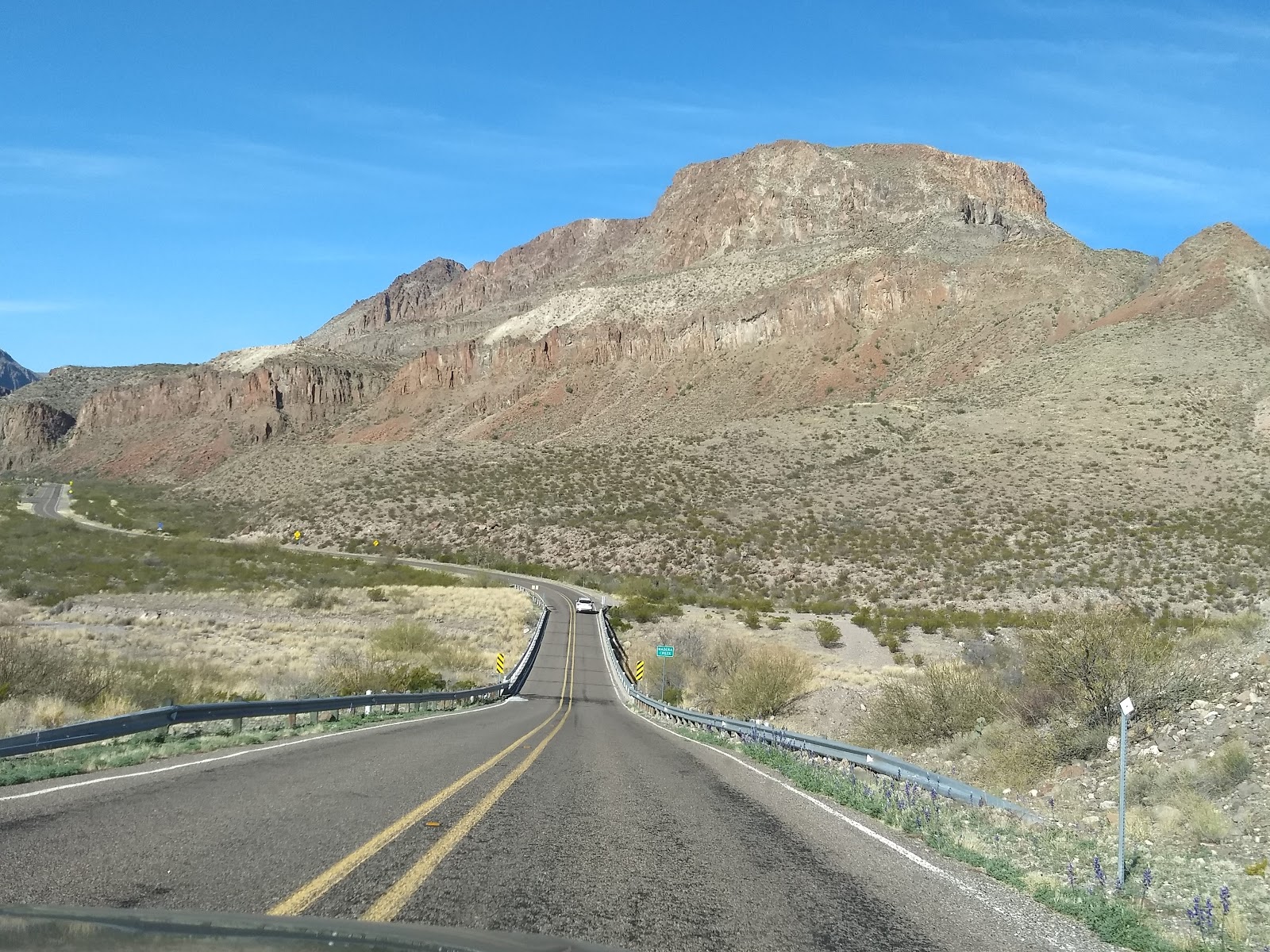
Our drive today was to take us from Terlingua back to El Paso, where we will fly home tomorrow. As usual, rather than taking the direct route via I10, we chose to take the sccenic route via Texas route 170, through Terlingua to Lajitas to Marfa to Presidio. This road has lots of curves and steep grades, including the steepest in Texas at a 15% grade. The scenery is fantastic and the drive resembles a ride on a roller coaster. It passes through Big Bend State Park, along mountains that border the Rio
Grande. But the scenery wasn't the only interesting feature of the road. Near Valentine, we passed an art installation: a a freestanding building—specifically a Prada storefront in the middle of  literally nowhere. https://en.wikipedia.org/wiki/Prada_Marfa West of Marfa, we passed what looked like a tethered blimp. It turned out to be a Tethered Aerostat Radar System (TARS). Per Wikipedia, "the aerostats are large fabric envelopes filled with helium, and can rise up to an altitude of 15,000 feet while tethered by a single cable. The largest lifts a 1 ton payload to an operating altitude providing low-level, downward-looking radar coverage. The primary mission is to provide low-level radar surveillance along the southwest
border of the United States and Mexico, the Straits of Florida and the Caribbean in support of federal agencies involved in the nation's drug interdiction program. This one is in Marfa, TX." 

Further on, we drove alongside a train carrying hundreds of military vehicles, from tanks, to jeeps to cargo containers. 

We loved the drive, the scenery, and the sights! Late in the afternoon, we arrived at our stay for the night at Homewood Suites near the airport. Their shuttle picked us up after we dropped off our car rental, dropped us and picked us up at a nearby restaurant, and took us to the airport the next morning.

Big Bend day 3, Santa Elena Canyon

Santa Elena Canyon
Lower Burro Mesa Pour Off (I'm the green speck)
Ross Maxwell Scenic Drive on the west side is our destination today. We first stopped at the Chisos Visitor center to see if there might be someone to take a look at my swollen and painful wrist. We were advised that there was an EMT ranger on duty. They called her and she arrived from another part of the park about 20 minutes later. She applied an ace bandage, and then we were off.

Ross Maxwell Scenic Drive runs from the main road west of Chisos Basin 30 miles to Santa Elena Canyon. Driving down this road is probably one of the easiest ways to see some of the best of Big Bend National Park. There are great views of mountains, desert and the river. We stopped at all the vista points on the road south: the Henry Wilson ranch, Sotol Vista (offering a view high above the desert floor), and Lower Burro Mesa Pour off trail. That trail leads to a box canyon where water from rains on Lower Burro Mesa cascade over the edge. In dry times (like when we were there), the water path is clearly evident. We stopped at the Santa Elena canyon overlook, then proceeded to the Santa Elena canyon trail. The Santa Elena Mountains run along the Rio Grande. The trail takes you into the canyon formed where it passes through the mountains. Because my wrist was still throbbing, I opted not to take this 1.7 mile round trip hike. I urged Ray to take it, and he did. I walked along the river and relaxed until he returned.
 Later that afternoon, we headed foir our stop for the night, Paisano's. When we arrived, Annette, the manager greeted us with the offer to upgrade our regular (wonderful) room to the suite. We gladly accepted. That suite had a kitchen and living room in addition to bedroom and bath. The suite was sweet!

Dinner again was at La Kiva--this time with live music.

Saturday, March 7, 2020

Big Bend day 2, Ouch! January 29, 2020

view from Lost Mine Trail
Today we head to the mountains to hike the Lost Mine trail. The trail is a steep climb through juniper oak and pine forest, with great views of Casa Grande and Juniper Canyon. It was a cool but comfortable day for hiking. We started with jackets, but soon shed them for shirtsleeves. The trail itself was rocky, and at one point, I stepped forward and my foot landed on a flat rock that was not stable. The rock wobbled. Then so did I. I lost my balance, but caught myself before I fell. Unfortunately, I reflexively extended my right arm to catch myself. The result was a severely sprained right wrist that immediately started to swell. We continued on for another mile or so, but I was worried that I would further injure it because I couldn't use my right arm to balance as there were a lot of loose rocks. So I decided to let Ray go to the top (maybe another half mile) while I waited at a nice vantage point off the trail.

We took a few other walks later in the afternoon, and dined at the lodge restaurant again.

Big Bend day 1, January 28, 2020

Since we couldn't check in to our room at Chisos Mountain Lodge until later in the day, we decided to head out to the eastern side of the park. Big Bend has 3 distinct feature areas going east to west: the river (the Rio Grande), the mountains (Chisos Mountains), and the desert (Chihuahuan). We started our exploration by heading east to the river area, and stopped at the Rio Grande Village area to take a trail to an overlook over the river. 

After that, we continued to the end of the main road to take the Boquillas Canyon trail. The trail takes you along the river to the mouth of Boquillas Canyon. Along the way, we passed a few little Mexican souvenir stands that run on the honor system. They
Mexican "store" on trail
had little wire figures, signs that touted "No wall!" and other stuff. A jar was left for passers-by to leave money. I can't say I was too happy to see this trash littering the beautiful scenery. Not far from the entrance to the canyon, a Mexican man sat on the other side of the Rio Grande, yelling at hikers to buy his stuff. Later, he took his canoe across to tend to his "store". For Americans who want to visit, if you have a passport, you can walk across a small bridge to visit the Mexican town of Boquillas del Carmen. On the Mexican side, we saw burros grazing on the hillside. The canyon itself is scenic, and the trail was an easy walk.

Our last stop was at the Hot Springs Trail. The trail passes by some buildings that comprised a resort here in the 1920s and leads to a hot spring. The fact that the spring was crammed with bathers made it easy to pass up. 

Finally, we headed to our resting place for the night at Chisos Mountain Lodge, the only lodging in the park. Our room was in Casa Grande, a section of basic motel rooms with 2 double beds and a balcony. The balcony did have great views. Dinner was at the lodge as well, the food was pretty good and the prices reasonable for national park dining places.


Paisano! January 27, 2020

We set off this morning from our White City motel accommodations and headed towards Big Bend National Park. We took Route 285 south out of Carlsbad, a road we will not soon forget. Over the years, we have driven thousands of miles and had the pleasure of seeing some of this country's most spectacular scenery: Beartooth Highway out of Yellowstone, Going to the Sun Road in Glacier, Dragon's Tail in Smoky Mountains, Northwest Passage Scenic Byway (Route 12 in Idaho). Route 285 is NOT like those. By far, this is the ugliest road we have even driven. Starting in Carlsbad, and for at least 50-60 miles, the road is not only flat, ugly desert, but it is lined with garbage. This part of New Mexico is oil country, and as such, it must support the industry here. Where there are buildings, they are mostly manufactured housing or RV parks. The wind that whips up across the desert makes this area very dusty. We stopped at one intersection, and the dust cloud was so thick we couldn't see more than the front of the truck across the road. It was a clear, sunny day. But the grossest feature of the ride was the string of litter along 60 miles. Nasty!

After a ride of about 4 1/2 to 5 hours, we reached our stopping point for the night, Terlingua, TX, population 58,  a small town just outside Big Bend National Park. We had reservations at Paisano Village RV park and Inn. The owners of the RV park built a small building that houses 2 rooms, and 1 suite. While the reviews for this place were excellent, we were still surprised at how wonderful it really was. We hadn't expected it to be so posh, with a walk-in rain shower, and premium linens.

Another delightful surprise was the restaurant we went to that evening. La Kiva is a small semi-subterranean restaurant and bar with an eclectic feel. The food was good, the atmosphere was great. We were blown away when we exited the building later on. We both had the same reaction: "WOW!" There were no exterior lights and the sky was papered with stars. What a sight!

January 26-27, 2020 Carlsbad

We've been to Mammoth Caves, Wind Cave, Jewell Cave, Luray Caverns and several others, but Carlsbad is the biggest and best so far. Will Rogers called the cavern, "The Grand Canyon with a roof over it." We took the natural entrance trail to go down, same as last time, where you descend the equivalent of 75 stories in 1.25 miles. The trail down in the cavern is another 1.25 miles. It's BIG!

We were happy that, same as our last visit here, there were not throngs of people visiting. The darkness and quiet enhance the beauty of this place, that truly looks like God's art gallery. 

2 neat moments yesterday: After spending 4 hours exploring Carlsbad Caverns, we took a little-used (that day) 9.5 mile gravel auto-tour road. The sights along the road were typical NM desert and canyon walls. We stopped when we saw movement along the side of the road, about 20 yards away: a small herd of 12-15 mule deer, one buck surrounded by does and juvenile deer. They were on alert, but didn't run. We watched for a few minutes, and they all bounded
away when we moved.
The second moment occurred while walking to a restaurant (just a short distance from our motel) in the evening. We noted something really large and bright in the sky-- too big to be Venus, we thought. Google SkyMaps showed it was Neptune and Venus appearing together as one bright blob. You can see it too this evening!