Thoughts Become Things

Saturday, October 17, 2020

Final thoughts October 17, 2020

5,529 miles

On our drives, we often talk about the little things that we enjoy or find interesting or annoying about RV traveling. Here are a few:

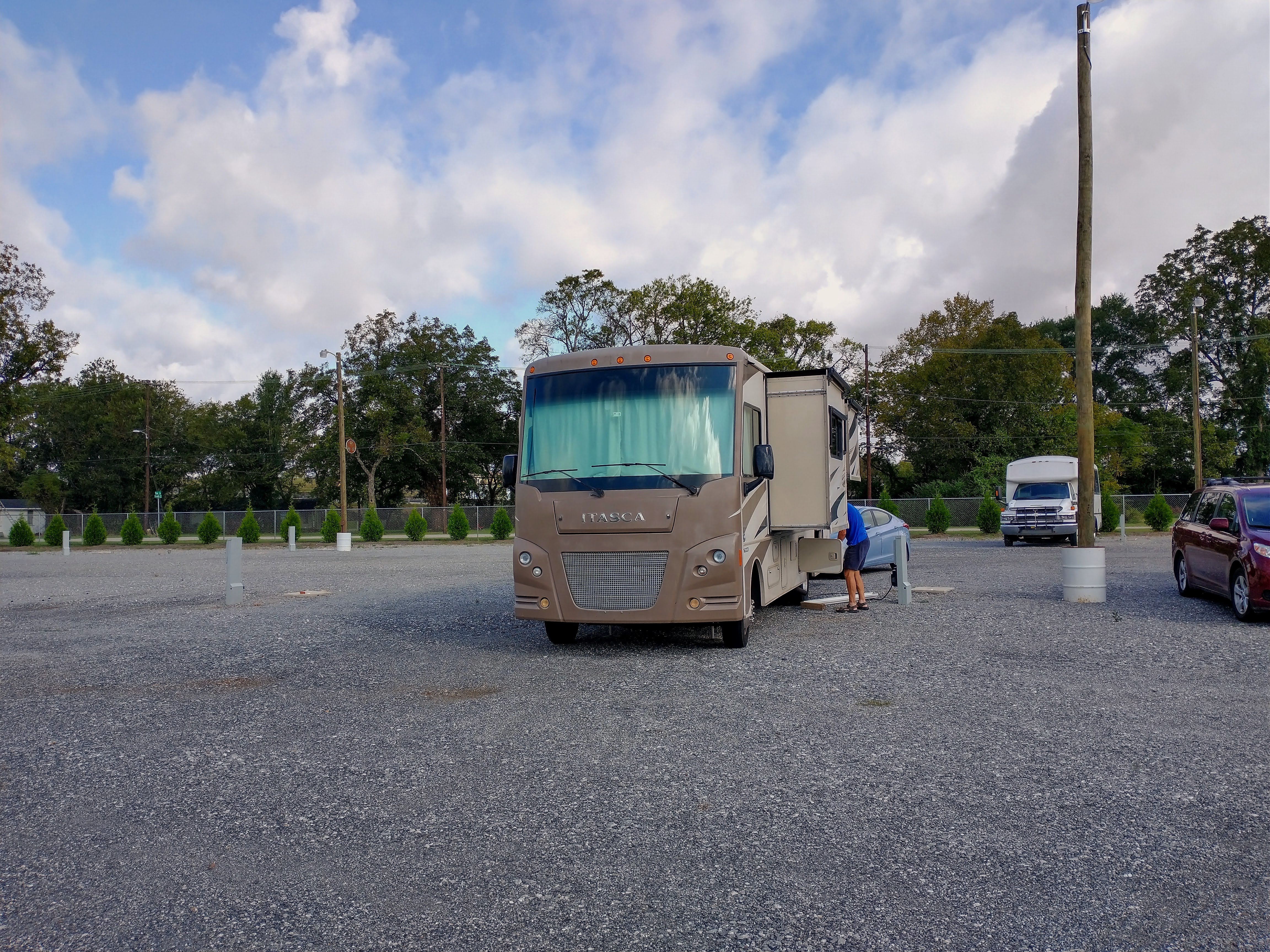
  • Finding a level site seems to be getting more difficult. When you park an RV, it's important that the entire rig be level so that doors will open properly, the refrigerator will work efficiently, and

    most importantly, you don't feel like you're walking up or downhill inside your rolling house. We have automatic levelers, and we found that even with them, there were quite a few sites where we had to roll up onto blocks to get the coach level.

  • iHeart Radio is great. We could listen to whatever station or podcast we wanted whenever we wanted. 

  • It would be great if, in construction zones where the open lane is narrow, they placed the cones in such a way as to make the travel lane at least a few inches wider. If you're driving an 8 foot wide rig, and the travel lane is 8'6" wide, there's not a lot of room for error.

  • From our previous travels, we became acquainted with the likes of Grit, Encore, ION, and Charge TV channels. It's amazing how many OTA stations there really are! This time, we saw many more. Have you heard of Cozi, Stadium, Hilsong, Enlace, H&I, Bounce, Justice, Dabl, and Positiv? 

  • The old series hold up over time. Perry Mason and the Untouchables are great (shown on those independent TV stations). We must be old. We love watching for people who became tv or movie stars in those series.

  • The things that we see in our travels prompt questions. How fast does the wind have to be blowing to move the wind turbines in a wind farm? Most  large-scale wind turbines typically start turning in winds of seven to nine miles per hour. Their top speeds are around 50-55 mph, which is their upper safety limit. Large-scale wind turbines normally have a braking system that kicks in around 55 mph to prevent damage to the blades. Who knew?

  • We learned that 95% of  the corn grown in this country is for livestock feed.

  • We'd like to request that farmers post a sign by the side of their fields letting people who drive by know what's planted in their fields.

  • Even though we had reservations for the most popular places (Arches, Great Basin) we visited, we had no reservations for the very busy RV parks everywhere else. But we still managed to get a space in some great places along the way. Everything works out.

  • Back roads are often a lot more fun. Detours, not necessarily so.


  • We don't know who will win this upcoming election, but we do know that Trump support in the states we traveled in is very enthusiastic. We saw Trump banners, signs, placards and flags everywhere. Along I70, we saw a stand of at least 20 trees with a Trump/ Pence sign tacked to each one. In all our travels, I think we might have seen a total of 5 Biden/Harris signs. And yes, we were counting.

  • Verizon is super. With unlimited data, we watched Netflix and Amazon Prime in places as remote as Baker, NV and Hanksville, UT where there were no other cell signals.

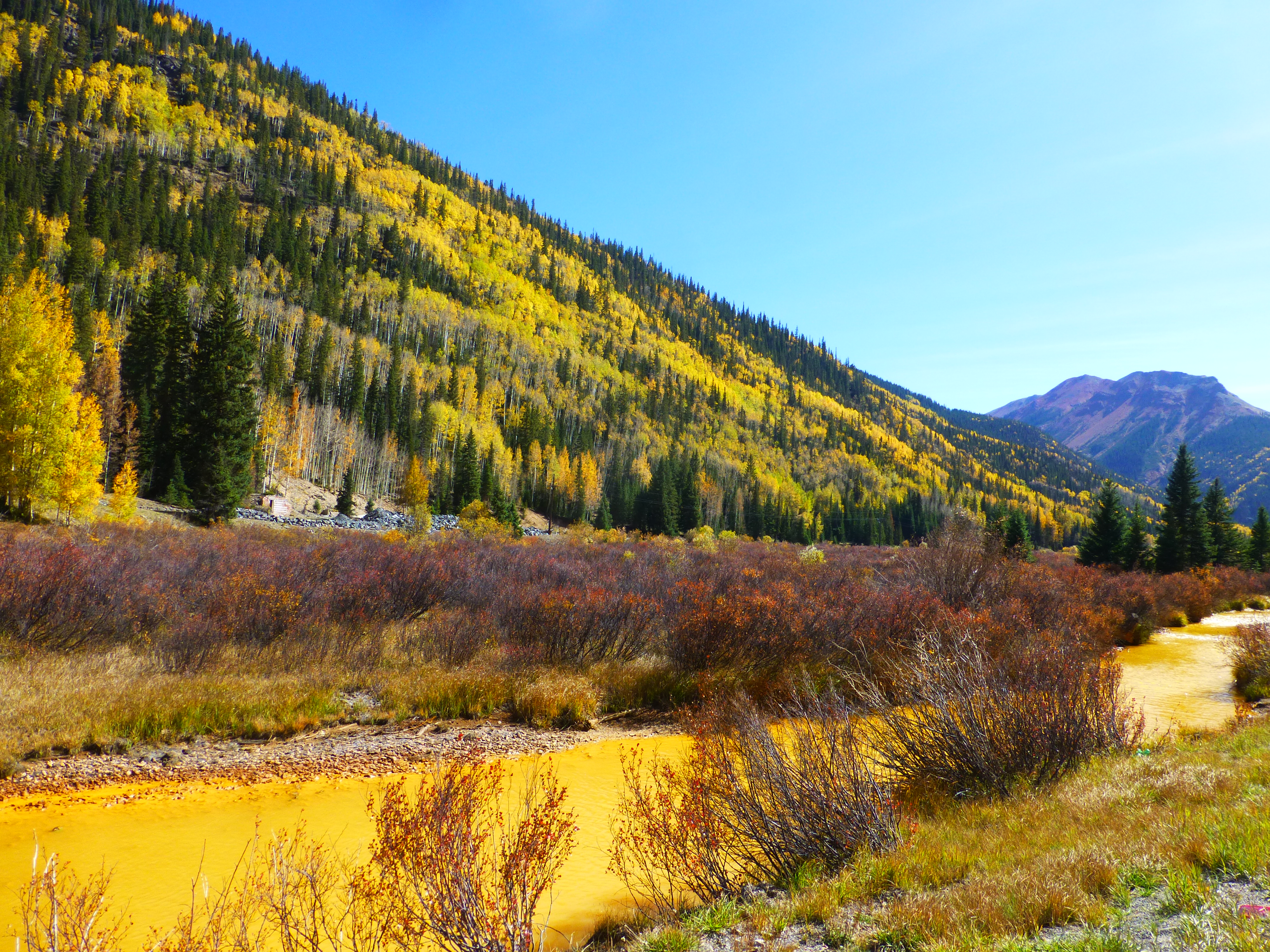
  • Most fun hike: Capitol Reef, Grand Wash. Second place: Canyonlands Needles, Slickrock trail

    Grand Wash, Capitol Reef

    Slickrock, Needles Canyonlands


Thursday, October 15, 2020

A garden and a forest October 13-14, 2020

We are blessed to have a wonderful spot on Mobile Bay where we can enjoy the quiet,


the breezes and the sunsets, which is what we did on Monday evening.  We spent all of Tuesday at the wonderful Bellingrath Gardens here in Mobile. I mentioned in my last post that we saw debris from Hurricane Laura on our way into Mobile. In fact, the damage was from Hurricane Sally in mid September. The gardens came through the hurricane well, but lost a number of big trees, and
Boat dock at Bellingrath. We sat here for a while-delightful!

cleanup is ongoing. There were very few visitors at the Gardens on Tuesday, which made it feel as if these were our own personal gardens. 

On Wednesday, we headed for the nearby Blakely State Park, the site of the last major battle on the Civil War. Some remnants of battlefield operations remain including the Confederate redoubts that cross the park. We use the All Trails app where we found a loop that would take us around the perimeter of the park. Fortunately I downloaded a map of the loop because we later discovered that this was a conglomeration of many trails in the park. As it was, trails were very poorly marked. We


started out on the trail, and had gone about a quarter mile, when we were reminded that we were back in the moist south. Mosquitoes were everywhere.. We had come prepared on our trip with bug repellent wipes. Unfortunately for us, those wipes were back at the RV. We turned around, went back to the car, and drove back to the RV (about 10 minutes away) to get them. We had gotten so used to hiking out west that bug repellent was not on our radar, but we definitely needed it for this hike. 

Back on the trail, we noted lots of tree damage, but not necessarily entire sections of forest. Most damaged trees were snapped in two, and there were many of those. Since the loop we were following was a joining of several trails, we followed the Alltrails map, similar to following a trail of breadcrumbs. At one point, it wasn't clear where the trail was that we needed to follow. We finally discovered that the trail had been buried in storm debris. After picking through that, we finally got back to the trail.

It was a spectacular day, and mid-afternoon, we stopped in the middle of a field and sat in the shade of a giant live oak tree to eat our snack. It was a lovely, peaceful moment.

We head back to Florida tomorrow, with a stop in Ocala before we go home on Friday.


Tuesday, October 13, 2020

Detour, October 10-12, 2020

 Our next stop on our way east and home was Nashville. The ride from St. Louis was uneventful until we passed the Land Between the Lakes, KY, a large National Recreational area. We noted on our Google route that I24 was closed for miles ahead. We exited the interstate just before bumper to bumper traffic began, and started a detour that took us over some winding and narrow Kentucky back roads. Traffic that had been diverted from I24 westbound was heading towards us on that road as well. That wouldn't have been any concern, except for the fact that at least 50% of the traffic on that road were fearless semi trucks, barreling toward us. At one point, we were met with a wide load coming towards us from the opposite direction. I swear that rig whipped by us with only inches to spare between our mirrors, each of us going 40 mph. It didn't help the situation that the road had no shoulders at all, and there was zero room to move to the right.

By the time we arrived in Nashville and set up, it was raining. We had been fortunate that the hurricane that came on shore in Louisiana petered out over land, and was not producing a lot of wind in our area. This was the first rain we had experienced in our whole trip so far.

From Nashville, we moved south to Montgomery, AL. The campground we stayed at was essentially a


gravel lot in an industrial area. It had been fitted with RV utilities (water connection, electric and sewer), and was located on the Alabama River near the Interstate. Surprisingly it was quiet, and happily it was clean and gated and essentially a pleasant experience.

On to Mobile, down I65, a beautiful drive. We are staying at Meaher State Park there. On the way, we saw a great deal of evidence of Hurricane Laura that blew through here at the end of August. Debris was piled up

You can see where the water line was in the August hurricane. It goes left to right behind Ray.

along the roads, and we saw downed trees along the sides of the Interstate as well as local roads.

Here our campsite is right on Mobile Bay. There is a line of plant debris about 20 yards away. Storm surge here was 2-3 feet. Weather is in the 80s and fabulous, and my sinuses are happy to have back some of the humidity they are used to. 

Saturday, October 10, 2020

Travel University, October 8-9, 2020

Under sunny skies, we continued across Kansas on Thursday. We motored past Russell, home of Bob Dole, Fort Riley, which I learned was originally established in 1853 as a military post to protect the movement of people and trade over the Oregon, California, and Santa Fe trails. The fort stores hundreds of military vehicles and equipment visible from I70. 

We noted many depictions of Jesus on I70. What was that about? I did  some digging and found that they were built by 4 men who are parishoners of Catholic churches in Gove County, KS. The billboards show the image of Divine Mercy, Jesus. The whole story about these signs is here:  https://www.emissourian.com/features_people/senior_lifetimes/seniors-distribute-1-000-divine-mercy-signs-throughout-state/article_cf9a73a7-0761-5e13-880b-5ab1498a4a8f.html

Our drive took us through the wonderful Flint Hills, an area that has densest coverage of intact tallgrass prairie in North America. It is all beautiful rolling hills where the land  meets the sky. The hills are best appreciated away from the highway. There's an incredible peace here. 

Through Kansas City and into Missouri, we passed many giant fields of sorghum, wheat and corn. In Missouri, we noted the increasing number of trees. 

About 60 miles west of St. Louis, we took a 70 mile detour off the Interstate to explore back roads of Missouri. As it follows the Missouri River, the road was narrow and winding, but had been newly paved for 30 miles of it. We passed farms, and  wineries and fields on the hills and valleys we rose and descended. We passed Dutzow, MO, the first German emigrant settlement in Missouri, and many entrances to the Katy Trail, the USA's longest recreational rail trail. That trail runs 240 miles along the Missouri. 

We are staying at a campground in Fenton, MO, and from here will visit the Missouri Botanic Gardens on Friday.

____

Another warm and sunny day in the 70s greeted us as we headed of to the botanic garden on Friday. Missouri Botanic Gardens is internationally known for its plant study materials, second only to the New York Botanical Garden. MBG takes its mission to inform and educate seriously. Most plants and trees are labeled, and many have additional information to give you an appreciation of the uniqueness of the specimen you're looking at.

We saw a tree whose fruit grows directly from the trunk, ferns that looked like caterpillars, flowers that


felt like wax, and a tree with a symbiotic relationship with a wasp. Highlights for me were the many mature trees with unusual and strikingly beautiful bark. We particularly enjoyed strolling in the Japanese Garden, the largest in North America, and anchored by a 4 acre lake. The serenity of the scene was heightened by the fall colors of the bushes and trees, and it was easy to enjoy with the many benches along the walking paths.

We saw Osage orange trees that were planted in

Osage orange

1860 and that were at least 60 feet tall. A sign nearby advised visitors to watch out for the 3-4" fruit falling from the trees. We had never seen what walnuts looked like on the tree until yesterday. There was a similar warning sign for falling fruit from the black walnut trees. No wonder!

Sadly, several large areas of the gardens were closed due to COVID. It's really worth a return visit.

Wednesday, October 7, 2020

Travel notes October 4-6, 2020

 After spending a great day visiting with my brother and sidter-in-law in the Denver area, we spent Monday doing errands and chores. I had a blood draw for an upcoming doctor's viit. We then did weeks worth of laundry at a local laundromat. Using the laundromat always reminds me of how grateful I am to have a washer and dryer at my disposal at home. $18 and about 2 hours later, we went grocery shopping to fill up the refrigerator and pantry. We just kicked back at the RV for what was left of the afternoon.

Tuesday was a drive day. We had made a reservation at a campground off I70 in Wakeeney, KS.From the campground in Larkspur, south of Denver, it was an interesting drive just watching the change in scenery. We went from hill and mountain views to rolling hills to plains in just a matter of hours. Trees gave way to farm fields. We rolled past large windmill farms, a herd of antelope, huge fields of sorghum, hay bales to the horizon, a large stockyard chock full of cattle and complete with a slew of mounds of manure. One of the windmill farms we passed was completely inactive. Not one vane was moving.

On a political note, we saw a handful of Trump 2020 signs in fields along I70, but not one BIden sign. Come to think of it, in our travels so far (over 3600 miles), we have never seen an RV with a Biden sign,


but have seen many promoting Trump, and usually enthusiastically so (many banners, flags and signs for 1 RV).

Once we arrived in Wakeeney, our attention turned to the hurricane brewing in the Gulf, Delta. Our plan (always subject to change) is to be in Mobile, AL by next Monday. The storm will be gone from the Gulf by then, but we'll have to traverse the remnants as it tracks inland. Rain isn't a problem, but wind over 30 mph is. So we'll be watching the storm's progress closely and be ready to change our plans as need be.

Sunday, October 4, 2020

Garden of the Gods, October 3, 2020


Garden of the Gods is a public park in Colorado Springs, CO with 1300 acres of towering sandstone rock formations. It sits at the edge of the front range, the easternmost section of the Southern Rocky Mountains. Since our visit fell on a Saturday, we opted to stay away from the main rock section (that was, in fact crawling with crowds of people), and hike a series of trails that runs the perimeter of the main rock section of the park. 

What made the hike interesting was that we needed to pick out the junctions of 4 separate trails. We were assured by a person at the visitor center that the trails were well marked. It would have been so much easier if that had been the case. We found that trails would start and stop without signage. Fortunately, we had a downloaded trail map on my phone to follow that showed us whether we were following the correct trail, and we only had to backtrack a couple of times.

We were amazed at the number of people with dogs on the trail, many with multiple dogs (as many as 5). The weather was perfect, and the wind had carried the smoke from fires northwest of Denver away from Colorado Springs for the day. 

Photos here: https://photos.app.goo.gl/UvfDwd6XiDXTB2vx6

Saturday, October 3, 2020

Colorado smoke October 2, 2020

Bounce anyone?

The ride from Browns Canyon is not a long one, but it does go over the mountains. A steady stream of RVs and cars headed in the opposite direction (west) and we assumed that Colorado Springs residents were heading for their weekend retreats further west. We could see that we were approaching Colorado Springs by the pricy McMansions on the hillsides as we moved east.

Even this far south, the smoke from the wildfires northwest of Rocky Mountain National Park was heavy in the air when we arrived at our stopping place in Larkspur, about 40 miles south of Denver.  We could smell as well as see it. A departure for us, we are staying at a "resort" campground, one that offers a slew of activities and entertainment for its guests in addition to a place to park your RV and hook up. This place is owned by Sun Resorts, a large company with units all over the states. This particular place had been a rundown independent campground, and Sun purchased the property and made it into this resort. It looks like they razed the original campground and rebuilt every site, adding propane fir pits and trex picnic tables. They paved the roads, remade the sites, built retaining walls, and added a clubhouse, fitness center, sports courts, a recreation center, 3 sizes of cabins. 

Why did we choose this place? It's closest to Cenrtennial, where we will visit family this weekend. Our ideal campground is one that offers a level site ( a rarity on this trip so far) that is quiet, steady electric, and good water pressure. We're not camping, we're traveling and staying in our rolling home.

But this place is a hoot. They have face-painting, ice cream socials, outdoor movie night (brrr!), mini golf, and much more. Want a campfire? There's a statewide ban on fires. But here, you can connect a propane tank to the propane fire pit, and voila!

Photos here: https://photos.app.goo.gl/domWRhWvhi8uJRzX7

Friday, October 2, 2020

Browns Canyon October 1, 2020

 Our trip to this area included the always interesting ascent up Monarch Pass at over 11,300 feet. Dragging a car 10 miles up (and down) a 7% grade puts a bit of a strain on the RV. But we made the trip just fine.

Buena Vista, CO is a jumping off point for Browns Canyon National Monument, add to the park system in 2015. The canyon follows the Arkansas River and is a popular destination for fishing, white water rafters, ORVers, bikers,  and hikers. Since it is so new, there is not a lot of infrastructure similar to other monuments and parks. There's no set entrance, just places where you can start hiking, or put into the river.

We stopped at one of the centers for activity, Ruby Mountain. The campground there looks great (dry


camping only), and there is a ramp for putting your boat into the river. The scene was lovely, and I walked down to the river to get a better view upriver. Rather than walk down the boat ramp, I figured I'd stay out of the way of anyone who might come and want to put their boat in, and I stayed to a slightly elevated way on the left of the ramp. Less than a minute after I'd started down this path, I heard a pounding noise to my right. A quick glance showed me 6 cattle galloping toward the river down the ramp less than 10 yards from where I was standing. They hit the water with a splash. Needless to say I was freaked out. Four of them crossed the river, and 2 stood in the water for a bit and took a drink. This IS free range country.

We then decided to take one of the trails in this area, and walked about a mile up the trail, with the idea that we would take a spur down to the river at some point. One of the problems with being a newer monument is that trails are not as well marked as in other parks, and maps don't show distances to trail junctions. With uncertainty as to where our river cutoff was, we decided to turn back.


We then drove up  CO route 306, a scenic ride that took us up to Cottonwood Pass, at 12,126 feet right on the Continental Divide (the next pass north from Monarch Pass). At the top, the wind was howling, and I could barely stand up. Ray took the .2 mile path to the highest viewpoint.

After descending the pass, we stopped at a town park in Buena Vista, and walked down to the river, a lovely spot.

Wednesday, September 30, 2020

Around the Moab area, September 26, 2020


We started the day with a drive down Kane Creek Boulevard, a road that runs from in town down along the Colorado River. Our first stop was at Matheson Wetlands Preserve, a tract of land set aside to protect the unusual wetlands here. The  scene is striking and beautiful: Wooded marsh areas in the desert with red cliffs behind. 

Further along the road, the cliffs rise up on both sides of the river. and we realized there were quite a few ORVs on the road. There was good reason for that: it turns out that the c


anyons in this area are prime real estate for off road activities. While we moved up the dirt road in 1st and 2nd gear, jeeps and ORVs buzzed by us leaving us to literally eat their dust. We could hear motorbikers and see bicyclists on the trails in the canyon. The scenery was spectacular. At one point the road transitioned to switchbacks to climb a cliff, and the edge of the road dropped away precipitously. 

Further along the road, we noted climbers hugging the rock faces of the canyon. When the road became too rough for our little Elantra (and us), we turned around and retraced our route.

We headed back to Moab and decided to take the road on the other side of the river, built originally to service the potash mines in the area. It passes by sheer rock walls popular with climbers, dinosaur footprints and Indian petroglyphs. We stopped at the trail to the dinosaur tracks and took the steep 1/4 mile trail up to them. The only problem came when the trail went straight up the sheer face of the rock hill. No way Jose. We headed back to the trailhead. It turned out that we could see the tracks embedded in the rock from the parking lot.

We decided to grab some subs and head for Arches for sunset, and returned to what I think was the coolest feature of Arches, the fins. 

Photos here: https://photos.app.goo.gl/Hy7S4HYHhPrwuSBt5


Special day, special place September 29, 2020


What more could we ask for? Perfect dry weather, pure blue skies, the magic of the steep, dark beauty of Black Canyon of the Gunnison, good health, each other's company, and for the topper, it was our 47th wedding anniversary.

A couple of weeks ago we visited the north rim of Gunnison. Today we hit the south rim. The park contains 12 miles of the 48-mile long Gunnison River. The national park itself contains the deepest and most dramatic section of the canyon, but the canyon continues upstream into Curecanti National Recreation Area which we will visit tomorrow. The canyon's name owes itself to the fact that parts of the gorge only receive 33 minutes of sunlight a day. Some canyons of the American west are longer and some are deeper, but none combines the depth, sheerness, narrowness, and darkness, of the Black Canyon. When we arrived, I swore to myself that I would stifle the urge to capture more pictures of this place. We've visited a few other times and we have lots. But at the end of every trail, there it was, the incredible grandeur of the canyon. I didn't keep my promise.

We stopped at every little trail that leads to the canyon rim, and stopped for lunch at one overlook

parking area, and pulled out our lawn chairs to lounge in front of the car on the road. Our only risk for the day in covid times was in using the vault toilet here. I've become expert at using a tissue to open the door, not touching any surface in the toilet, using tp to open the door on the way out, and applying a liberal amount of hand sanitizer after.

The views from each vantage point are fabulous, and the overlooks get you right next to the edge of the canyon. When you're at the railing, you can usually look straight down the sheer rock wall on top of which you're standing. 

We ended our visit here with a drive down to East Portal, a former town located down on the Gunnison River at the bottom of the canyon created by people who built the power plant there. A more peaceful spot doesn't exist. We sat for a while in the complete quiet of the place just enjoying the perfect moment. The sky was so blue that the jagged tops of the mountains around us looked like cutouts against it. 

It was a very happy anniversary for us.


The Million Dollar Highway September 30, 2020

The Million Dollar Highway is the stretch of Route 550 in Colorado between Ouray and Silverton. The name came from a planning meeting in the 1920s where, while discussing rebuilding the highway between Ouray and Silverton, someone at the meeting remarked that the project would cost a million dollars -- an incredible sum for such a short span of road construction at the time. Once construction was complete, the name stuck, and the Million Dollar Highway was born.


Though the entire stretch has been called the Million Dollar Highway, it is really the twelve miles (19 km) south of Ouray through the Uncompahgre Gorge to the summit of Red Mountain Pass which gains the highway its name. This stretch through the gorge is challenging and potentially hazardous to drive; it is characterized by steep cliffs, narrow lanes, and a lack of guardrails; the ascent of Red Mountain Pass is marked with a number of hairpin curves used to gain elevation, and again, narrow lanes for traffic—many cut directly into the sides of mountains. During this ascent, the remains of the Idarado Mine are visible. Traveling north from Silverton to Ouray
The edge of the road is where the slope drops off

allows you to hug the inside of curves; traveling south from Ouray to Silverton perches you on the steep outside edge of the highway. We went both ways. It was a fun and stunning ride.

From Montrose we headed south to Ouray and stopped at Box Canyon to view the falls there. The property is owned and run by the town of Ouray. The falls walk takes you along the side of a cliff to a box canyon through which there is a waterfall. The town built a walkway to make the walk easy for all. 

After Ouray, we headed south for Silverton. We had never really seen a Colorado fall. At this elevation (Red Mountain Pass is 11,000+ feet), the aspens were at peak. While we have been around the country in fall, and have never seen such glorious color as is in New England in autumn, fall in the Rockies is pretty special. The golden trees set among groves of spruce and pines, highlighted by sunny, blue, blue skies and lit by full sun are a sight to behold. 

On the way back, we stopped in Ouray again to see if we might be able to take a peek at the restoration of the historic Beaumont Hotel. No such luck. Covid regulations allow for guests only in the hotel.

We have noticed that a lot of people here wear masks on the trails. Half of those wearing masks wear them under their nose, or loose around their face. Many wear neck gaiters, which, as I understand it, are the equivalent of wearing nothing at all.

More photos are here: https://photos.app.goo.gl/buFAy72LLP8EwcYh7 By, the way, one of the photos (maybe two) looks like the the water is yellow. It was! We're not sure what caused it, but it wasn't the reflection of the trees in the water!

Edit: We now know what causes the water to turn yellow.  https://www.telluridenews.com/the_watch/news/article_7084178e-0765-11e8-ad17-b75e13bd7439.html

Saturday, September 26, 2020

Canyonlands Needles area


Canyonlands is actually made up of three distinct areas: Island in the Sky, Needles and The Maze. Island in the Sky is the area we visited the other day where you're up on the mesa looking down at the canyons. The Needles forms the southeast corner of Canyonlands and was named for the sandstone spires that dominate the area. The needles themselves are accessible only by strenuous hikes. 

The drive from Moab takes you 40 miles or so south and then 34 miles into the park. That last 34 miles are fabulous. It passes by Newspaper Rock, a rock wall where Native Americans have been engraving and drawing  for over 2000 years. Further up the road toward the park, sandstone cliffs rise on both sides of the narrow road. It's a spectacular ride.

Our first stop in the park was at a short hike to a 1000 year-old Native American storage building tucked under a rock overhang. Amazing that it was completely intact. 

We also took a hike on the slickrock to some panoramic views of the park. We were overwhelmed by the vastness of the landscape, and it was a hike we both greatly enjoyed, even though the wind was blowing pretty hard. 

We took another trail up on the slickrock that provided distant views of the Needles and some neat rock formations.

Great day!

Photos here: https://photos.app.goo.gl/73yGh7g77vxbBGrX6  The video is of some of the road into/out of the park.

Scenic Drive day


Along Rte 128

We took Thursday to make the scenic drive into and around the La Sal Mountains near Moab. That connects with Route 128, a wonderful road we found many years ago on a trip here. It is a back road from I70 to Arches. Many choose to drive from I70 to Utah 191, but though this takes longer, it's knock-your-socks-off gorgeous.

The La Sal mountain road is all paved and takes you from desert to mountains to forests to open range (we did meet some cows on the road) to red rock country. In one area, we passed mountains whose sides looked like they had been watercolor painted. It was just the mountainside vegetation that was changing to fall colors. It was a captivating effect, and difficult to capture in photos. The road passed through an aspen forest, and some of the trees were changing, but most were still summer green.

We were surprised by the number of large trucks driving this narrow, winding road, and noted a number of resorts here. We noted that the highway department was stockpiling sand in one area for the coming winter. We stopped at one point at an overlook and joined about 20 ATVers who apparently were rallying there.

Mid-afternoon, we pulled to the side of the road, took out our lawn chairs, sat by the side of the road, and had lunch. This was a nice kick-back day.

Photos here: https://photos.app.goo.gl/apEk8LHwNxuAwmzT7

Thursday, September 24, 2020

Canyonlands


We drove the 30 or so miles south to Canyonlands National Park yesterday. It's startling to go from all those huge spires and rock features to mostly flat mesas where canyons rule. Arches is a place where you're almost always looking up. Canyonlands is a place where you're always looking down. 

Sheep and cattle ranchers settled this area in the 1800s. There is a primitive 4WD road that descends the canyon and loops around that was used originally by the Native Americans, then used by the

Shafer Canyon road

sheep ranchers, and now is used by off roaders to explore the canyons. (Sheep sometimes fell off the steep road and perished.) Cool to look at, but I wouldn't drive it.

We hiked about 8 miles today and the pictures, again, tell the story. 

https://photos.app.goo.gl/PwhjdshMfqaGKUDz6


Wednesday, September 23, 2020

Arches and Fins


We spent most of today walking trails at Arches National Park. The sheer enormity of the rock walls here, the utter quiet when you walk the trails away from the crowds, the beauty and uniqueness of each wall, arch and fin, make this a special place. This is our fourth visit here since 1992. Lots has changed here since then.

Moab has gone from a nowheresville little town with killer scenery, to a major natural destination with a 4 lane freeway running into it. But the arches , fins, walls and spires are all, blessedly the same.

The photos tell the story: https://photos.app.goo.gl/z9HWgusBS9W6zB6M8

Monday, September 21, 2020

Back across Utah


We  headed back across Utah today, this time to visit the Arches/Canyonlands area. Both parks are beautiful, and the landscape around here is unique. We plan on taking some local back roads.

Our drive started out unremarkably in Nevada desert that transitioned to Utah desert. Nothing special until we passed Salina, Utah on I70. The road after that was one surprise after another, with colorful and interesting rock formations rising near the highway. Each successive curve in the road was a new "Wow!" and the landscape revealed itself. Very cool drive.

We were prepared for the fact that Moab would be overrun. Pandemic traveling has packed many of the most popular national parks, Arches among them. But we were surprised by the construction traffic in Moab, where they are widening the main road through town to 4 lanes. We hit bumper to bumper traffic for several miles before we came to our campground.

At the campground, we checked in and were taken to our campsite. It took us over an hour to just get level. The site was sloped back to front and side to side, to the point that, when leveled, the front wheel were off the ground. A campground employee brought us some wood on which we could rest our front wheels, and assisted us in getting level. I asked at the office if we might be moved, but they had no other sites available. 

Photos are here--(splotches in the photos are from bugs on the windshield). All photos taken after Salina, UT on I70. https://photos.app.goo.gl/7vqk9BjgTpSe1haV6

Another remote site, another dirt road

Laundry day! It's these mundane chores on the road that make you appreciate the conveniences of home. But a $2 a wash, we figured we'd get it done today here at the campground. 


Once the first half of the laundry was done, today's destination was a location in the north of the park that had been scarred by wildfire in 2016. Access to the area we wanted to visit, was, as with most areas in Great Basin, by way of a dirt road. Actually, this road was in somewhat better condition than either Baker or Snake Creek. The road wasn't as washboard or rocky, but there were sections that were barely passable by a single vehicle. We drove with the windows open, and there were a few times that brush at the side of the road almost smacked both of us in the face. We moved along slowly, praying that another vehicle was not advancing from the opposite direction. In most areas, there was no place to pull over.

At one point, we came upon cattle in the road. This area is open range. We inched forward, and the cattle moved to the side of the road. We finally reached the trailhead at the end of the road, and found one other car in the parking area. We set out on the hike that took us along an open field and then into a burned area of aspen forest along a creek. When the fire happened in 2016, it was feared that the elk in this area (there are many) would be deprived of their food source and habitat. On the contrary, they have thrived here, as was evidenced by all the elk scat on the trail.

After completing that trail, we opened up our lawn chairs in the parking lot to have lunch. By this time, again, we had the place to ourselves. 

We decided to try another trail, but were uncertain where its start was. We looked at maps, and guessed at which direction to head off. We trekked up a hill, maybe a 1/2 mile, only to discover that this was not the way we needed to go. We decided to retrace our steps before we had gone too far down a trail we didn't want to follow. 

Back to the RV to finish the laundry and kick back.

Photos here: https://photos.app.goo.gl/Mr4n35p5PRhGjXSh9

Sunday, September 20, 2020

A whole new day: September 19, 2020


Yesterday we had inquired at one of the satellite visitor centers what conditions of the dirt access roads were in other parts of the park. (We had in mind our crazy ride down Notom Road at Capitol Reef.) The ranger recommended against driving them in our car because of rough conditions, and that we should only go with a high clearance vehicle. We were somewhat disappointed, as there were hikes we wanted to take in those areas.

Today, we opted to stop at the main Visitor Center and inquire once more about those roads. "No problem! I drive them in my Malibu!" was the reply. So, off we went to a southern area in the park. 

The road out to the trailhead was 15 miles of washboard dirt. We're getting used to this. It wasn't as bad as Notom Road at Capitol Reef, but there were a few spots where the 2-way road was definitely only wide enough for 1 vehicle. Trees and rock lined the road to eliminate any chance for 2 cars to squeeze through. On our way back up this road later this afternoon, we met at least one large truck with a trailer coming at us from the opposite direction in one of these 1-wide spots. Generously, he immediately backed 100 yards down the curvy road. What a champ!

We stopped at the trailhead near the end of the road, and were pleasantly surprised that no one else was there. The day was clear and cool, and in this area of the park, the smoke was not as heavy as we experienced yesterday. Our trail took us up the side of a hill through fields of serviceberry and sagebrush to a lovely aspen forest and a grove of mountain mahogany. As we gained elevation, we


loved the grand views of varying shades of green punctuated with the gold of autumn aspens. The mountain mahogany trees grow in semi arid areas and have contorted shapes. This stand of trees reminded me of a spooky goblin forest. At one point we came upon a dead fawn right by the side of the trail.

Mid-afternoon, we found a large rock in an open area where we could rest a while and enjoy liunch. We ate in view of the mountains. 

When we finished this route, we decided to head to the end of the road and take one more  hike to what turned out to be another obscured overlook. Park Service: Cut some trees, or don't call it an overlook! We passed a huge dead limber pine that had lost all its bark, but still had most of its branches. The trunk was a gorgeous swirl of color. 

Photos here: https://photos.app.goo.gl/Vow2LFb5uqnVi3jb7

Elevation, Smoke, and Rocks

Here in Baker, NV, cell coverage is 3G only, and as usual, campground wifi is weak. So timely blog posts are difficult.

 On Thursday, we headed west to Great Basin National Park in Baker, NV, one of the lesser visited parks in the lower 48 states. There is a reason for that. It's located literally in the middle of nowhere. From Capitol Reef west for 238 miles, the landscape transitions from red and white rock walls and formations to desert. Towns along the way are few. For one stretch of 100 miles, there are no towns, no trees, no roads. See for yourself here

 Great Basin sits a few miles from the Nevada-Utah border, and when you cross the state line, it

transitions from Mountain to Pacific time. Our RV park for our stay of 4 nights, is in Baker, a short walk to the Great Basin Visitor Center. Surprisingly, it's quite nice. We had no idea what to expect in a town whose population is 68. The site are shaded by what are presumably elm trees (the park's name is Whispering Elms). 

 Our first day here, Friday, we set out for Wheeler Peak Scenic Drive. As scenic drives go, it was just OK, with really not much to see from the road. At the top of the road, at 10,000 feet, we took a trail that climbed to 2 lakes. Well, it really was one lake and another wet spot. The trail was moderately steep, and extremely rocky. The path in many places was a rock field. I did find myself short of breath,
This is what most of the trail looked like

and had to take many rest stops. I consider myself in pretty good shape, but the 11000 foot+ elevation and heavy smoke from the west coast wild fires took their effect. Many hikers we saw on the trail were wearing masks. But we suspected that it wasn't because of Covid, but just the darn smoke. My eyes were continually watering, and my sinuses clogged. Not my favorite hike ever.

 We then drove up to the Wheeler Peak "Overlook". I use quotation marks on the word overlook, because there were trees that blocked much of the view, with a "peep hole" for the peak. A bit of judicious tree-cutting would have provided an expansive view of the mountains. 

We next headed over to the Baker Archeological Site, a place where, in the 12th century, Native Americans had built a community. Nothing is left but some reconstructed walls. What a god-forsaken place. Maybe the climate was different then. 

Unfortunately, even though this is a dark sky area where star-viewing is usually exceptional, both the smoke and passing clouds obscured the display that night. This was an inauspicious day 1 for this National Park.

Pictures of the hike and overlook here


Thursday, September 17, 2020

Another road and a wash September 16, 2020


Scenic Drive

We started out our exploration today with a drive down the (paved) 8 mile long Scenic Drive south from the Visitor Center. This road winds past dramatic cliffs and spires and ends at Capitol Gorge where the road turns to dirt. We stopped there for lunch where we chatted with a couple who had flown in to Salt Lake City from Chicago and were touring Utah's National Parks. In 10 days they were visiting Bryce, Zion, Arches, Canyonlands and Capitol Reef! That's about 1000 miles of driving alone.We  figured they must just plan to drive through each of the parks.

After lunch, we headed to the Grand Wash trailhead. Grand Wash is a gorge that cuts its way through the Waterpocket Fold we drove over the other day. It winds its way through massive textured and

In the narrows of Grand Wash

rainbow colored walls of stone. What a fun walk! The pictures tell the story. When we got back to the RV after our walk, we noted that it was impossible to tell what the original color our shoes were. They (and our ankles) were covered in the orange dust we were walking in.

After dark I stepped out of the RV to put out the day's trash. There was one exterior light in the campground, but otherwise the area was pitch black. By that one light, I could see many bats darting and swooping (what seemed like) close to me. I dashed to the dump area and back. Unfortunately, the smoke from west coast fires somewhat dims what otherwise would have been an awesome night sky.

Photos here: https://photos.app.goo.gl/oN4jtp8sfNjww9L3A

Wednesday, September 16, 2020

Looping the Fold September 15, 2020


At the top of the switchbacks

We are staying at a campground that is about a 37 minute drive from Capitol Reef National Park. It was the closest we could stay and get 3 consecutive nights accommodation, especially on short notice. It's pretty much what we look for--roomy sites with good water pressure and reliable electric and sewer connections. The campground is pretty basic, but it's quiet here. I went out in the evening to put in the awning, and there were several sheep browsing by a fence nearby. Bats swooped, looking for their evening meal.

This morning, we stopped at the ranger's station to pick up a park brochure (the visitor center is closed), and drove by a glorious pair of trees. They were massive cottonwoods. The sign nearby indicated that the one closest to the road was the place where mail was transferred from carrier to carrier, and so was called the Mail Tree. So beautiful!

Our destination this morning was the Loop the Fold road, a 124 mile drive that starts out paved, and then treats you to some pretty rough road, ending up with nice and smooth pavement. It took us about 5 hours to complete it.The "Fold" is the place where the earth's crust rose, but did not crack, creating a fold. 

We had read that the unpaved part of the drive would be easily navigable by a passenger car, so we figured that it would be easy peasy. We've been on many unpaved roads in the Elantra and had no problem.So we started out down the first 15 or so paved miles with great expectations for what was to come. Then reality in the form of severe washboard road conditions hit. The fastest we could go without destroying the suspension was about 10 mph. Ray had the car hugging the right side of the road where the washboard was minimally better, but in a couple of instances we had to veer to the other side of the road to avoid giant dips in the road or voids in the road surface. Thank god there was very little traffic on the road (surprise, surprise!). 

The scenery on the first part of the road was fascinating. We traveled 38 miles south on the road between 2 ridges. we were driving with "the fold" in the earth on the west. It was wild and lonely country. (In the late 1800s, Mormons settled this land in hopes of being able to farm here.) We were most focussed on just moving forward and not wrecking the car. Once we made the turn off for Burr

This was the angle we were ascending the switchbacks

Trail, the real fun started.  At this point, the road turns west to go across the rock reef. The washboard road then turned into switchbacks climbing the ridge. And all of a sudden, the road was surrounded by huge, gorgeous rock formations. For a mile or so, we climbed the switchbacks on the rutted dirt road. Having a standard transmission made it dicey to stop to admire the impressive views as we ascended the gravel road. But oh, my! the views were stupendous, so we stopped anyway.

After another 4 miles, we were back to paved road, and preparing for a real treat. We traveled through White Canyon flats (white boulders) to the towering red cliffs of the

In Long Canyon

massive Long Canyon. What a visual treat! The rest of the road took us through forests of aspen, then aspen and spruce, then pine, and back to the main road. We did notice that views from the west side of the fold were marred by smoke from wildfires in California.

We're looking forward to our hike in Grand Wash tomorrow.

Photos are here: https://photos.app.goo.gl/LtZeaFn2Ma3LCazc8

Monday, September 14, 2020

North rim of Gunnison September 13, 2020


From our base at Grand Junction CO, we drove south to the north rim of Black Canyon of the Gunnison. As with the north rim of the Grand Canyon, the north rim of Gunnison is much less visited and so, by our estimation, more attractive a destination. It did not disappoint.

Some of the trip is on well maintained dirt roads. We took the short drive along the rim and a few short walks to the canyon edge and marveled at the spectacular vista before us. Black Canyon is steep, high, and narrow. It's called the "black canyon" because  its steepness makes it difficult for sunlight to penetrate into its depths. As a result, the canyon is often shrouded in shadow, causing the rocky walls to appear black.

At overlooks, the barriers at the edge of the canyon are a little more than thigh high. While they are sturdy and safe, you can get the feeling that you're going to blow right off the edge. Drop offs just behind the barriers are sheer and very deep. In some of my photos you'll see Ray standing well back from the barrier. He has a pretty developed fear of heights.

After checking out the rim drive, we hiked to exclamation point, a walk that takes you through some scrub and treed areas to a final view that makes the walk worthwhile, straight up the canyon. 

When we got back to the RV late in the afternoon, we discovered that we had inadvertently picked up a hitchhiker, probably in Missouri. A mouse has joined us for the ride! We will be stopping at Walmart on our way out this morning to get some traps to end his journey with us--permanently.

Tomorrow we head to Capitol Reef in Utah.

Photos of the day here: https://photos.app.goo.gl/LgV9taAk5Y3yjVZS8

Sunday, September 13, 2020

Driving, driving, driving

We have moved across the rolling hills of Missouri to the gentle hills of eastern Kansas and the plains of western Kansas to the Colorado high plains and finally, the Rockies, 2,143 miles into our journey, we have come to the area we most wanted to explore. Some places will be new to us, others, more familiar.

Some impressions of our drive so far: 

Not sure what the Kansas DOT is doing in and around Kansas City, but the I70 detour around construction is crazy. It would have been helpful if the signage was more complete. In some places, we were left wondering where we were supposed to go. There nothing quite like driving a 28 foot beast and towing a small car in a 4-6 lane construction area where the roads all intersect. In one area, we got onto one road, only to have to cross 4 lanes of traffic to make a left exit. Big kudos to Ray for keeping it together here.

Most people believe that Kansas is the flattest state in the US. Drive across the state, and you will see that is not at all the case. The eastern third of Kansas is a mesmerizing scene of blue sky meeting mostly treeless  green rolling hills bisected by the road. We didn't stop there, but we have visited the Flint Hills and Tall Grass Prairie, and have come to really love this landscape. Most people think Kansas is the flattest state in the nation. In fact, it is the 28th flattest state in the US, gradually rising 3400 feet in elevation from east to west. 


We stayed at a KOA in western Kansas. The campground wasn't far from I70, but far enough away that you really couldn't hear road noise. It was a really peaceful spot. We were preparing to leave in the morning, when I saw the proprietor walk from the office towards a clearing with a flagpole. He was carrying a folded US flag, and proceeded to raise the flag. I was moved by this simple gesture on this gorgeous morning. In these crazy times, it seemed like an important thing.

The entrance to Colorado on I70 is not what most people think of when they imagine Colorado. The Colorado high plains greet you there. If there wasn't a sign there, you'd be hard pressed to know where Kansas ends and Colorado begins. But Colorado has an incredibly diverse land structure: alpine mountains, high plains, deserts with huge sand dunes, and deep canyons. It's always a cool feeling after having driven the eastern third of Colorado, to spot the "purple mountains majesty" rising in the distance


We drove through Glenwood Canyon, an area that was the site of the Grizzly Creek wildfire just a few weeks ago, and has burned over 32,000 acres. We saw evidence of the fire on scorched bridges and road decking and brush and trees by the side of the road. The road is normally split into east and westbound decks. All traffic now travels on the eastbound deck as repairs are accomplished.

Tomorrow we head to the less visited north rim of Black Canyon of the Gunnison.

Wednesday, September 9, 2020

Observations along the way September 8, 2020


 It's the little things that all add up to a unique experience, and what makes our travel so interesting. Travel is so much more than the experience you get at your destination. As we drive along, questions come to mind. A sign might prompt a thought. A vista brings back a memory.

Today was a travel day: one where we are focused on moving toward our ultimate destination, with the understanding that it will be a few days before we get there. On the way to our stopping point for today, Forsyth, GA (which we really hadn't chosen until we were 2/3 of the way there), we passed through Florida's hills (yes, there are bona fide hills in FL) in Lake and Marion Counties. It's gorgeous country with horse farms, and green pastures, and very distinct from the tropical nature of south Florida, and the beaches that line the coasts. Beautiful.

On the road, we saw a shrink-wrapped boat being towed north. How do they do that? What is the process? A quick check with Google showed me that the boat is cleaned, and perimeter strapping is attached along with supports. Then large sheets of shrink vinyl is laid over the boat and heat is applied with a propane heat gun. Who knew?

Sign of the times: We found it interesting that in a couple of places electronic road signs that might usually say " Slow Down" or "Click it or Ticket" now advise "Wear a mask" and "Social distance".

As we passed through Irwin County, GA in south central Georgia, we saw signs for the 12,000+ acre Jefferson Davis Memorial Historic Site. How weird is it that there are state-sponsored monuments honoring traitors to this country? Weird.

We are always appreciative of the many truckers that move our country. What stupidity and foolishness they have to endure daily on the roads to get our stuff to us! We saw multiple instances of people cutting off semis.

It was curious to us that when we stepped out of the RV in Georgia, we both noted how much cooler it felt. It wasn't the temperature (it was 87, not so different from back home), but I noted that the humidity was 40%. The last time we had humidity that low was probably in April. 

Heading toward Kentucky tomorrow.

Monday, September 7, 2020

Excited to be traveling again


Back in July, we had a 6 week trip planned that would take us to, among other places, Glacier National Park. We had looked forward to hiking the High Line and Iceberg Lake Trails, and scoping out the many wonders of  the place. The peace we find there is indescribable. But then came COVID. Since things were closing up, and access to Glacier was limited, we decided to travel later. Later is now.

So now we're headed as far west as Great Basin National Park in Nevada, with stops at Arches, Canyonlands, maybe Capitol Reef, Gunnison and some other places. Our 6 week trip starts tomorrow. We recognize the fact that we are so blessed to have the time, health, means and ability to do this, and I thank God many times every day that such is the case. There's nothing quite like the feeling of sitting up high with a panoramic view of the American countryside as it rolls by. We sleep in our own bed, get up whenever we wish, and take our time to drink it all in. Our masks are handy, as are hand sanitizer and wipes. We're ready to go. Tomorrow.